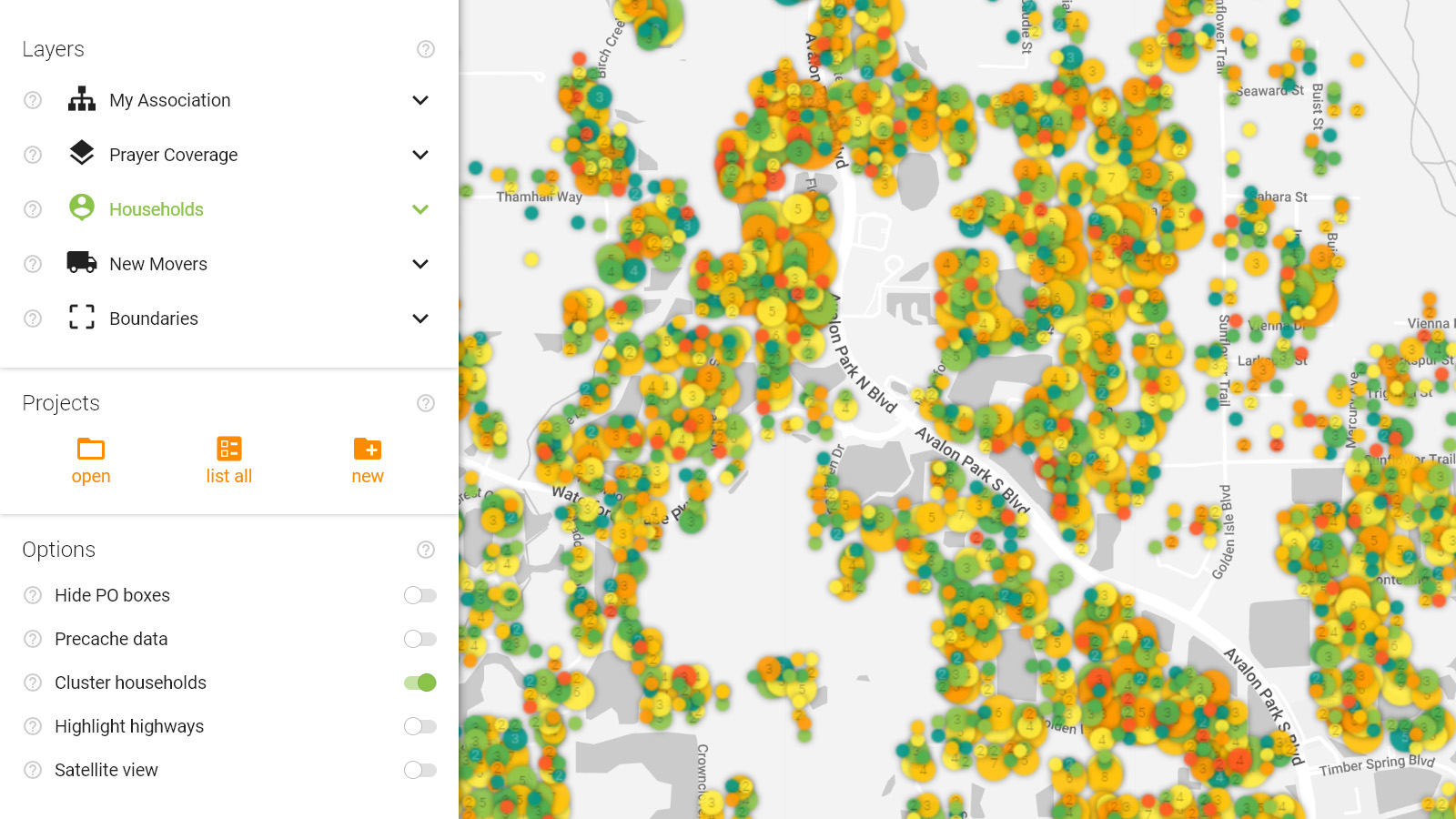
When viewing your map with one of the household layers turned on, it may be hard to decipher certain households when viewing the map from higher elevation because the icons become quite small. With this option activated, the houses are grouped together with nearby households that share the same color of the currently applied layer. Larger circles represent higher concentrations of homes that match the currently applied household layer.
When your map scale is zoomed in to 200 meters/1,000 feet or less, a number will appear in the center of the circle which represents the number of households that the cluster represents. Small circles without a number in them represent single homes. Once your map scale is zoomed in to 50 meters/200ft or below, the icons will change into individual squares which are clickable.
When households are clustered, the amount of data that needs to be downloaded from the server each time you move the map or change filters, is substantially decreased, speeding up map map generation.
This option can be used with all layers and filters.